Our project to photograph and measure waterfalls we visit

Friday, April 22, 2016

Little Nestucca Falls

On Wed., April 20, we drove and hiked to the Little Nestucca Falls. The story of this adventure is on my Ramblings blog: http://lindafink.blogspot.com/2016/04/our-latest-greatest-waterfall-adventure.html

The falls is located within Oregon State Forestry land with no trail or easy access. We took FS road 2281 from Sourgrass Summit on Hwy 22 into the northwest corner of Section 10 and hiked from there down to Fall Creek and followed it to the Little Nestucca River junction. The falls begins shortly after Fall Creek and the Little Nestucca join together. lat/long 45.078483 -123.753433

Lots more photos and a description of our route in and out are on the link above.

Below is the first drop from two angles.


And the entire falls...


The Northwest Waterfall Survey says it is 75 feet tall, but that includes three separate cascades. The top one is a sheer drop that Johnny estimated at 25 feet. The second is a cascade of maybe 35 feet. The third is a less steep cascade of, presumably 15 feet, although these are all rough estimates. Taken together, the falls are spectacular.

Saturday, April 16, 2016

Cosper Creek Falls and Kissing Rock


On April 13, 2016, we drove to Cosper Creek Falls on Hwy 22, Hebo Rd., just north of Valley Junction where Highways 18 and 22 separate. In the tight bends a pull off on the east side of the road is a popular spot for locals to pull into. A large boulder sits there and is usually painted with graffiti on the flat side.. and then covered over with more paint and so on. But the side toward the road is not usually defaced. The rock has quite a history locally.

Fifty or more years ago, that road was seldom traveled. Teenagers used to park there with their girlfriends, hence the name Kissing Rock for the big boulder that sat within view of the 10 foot waterfall just over the bank. However, at some time back then, someone blew up the rock. Apparently the deed was done by one of the teenagers who became, like most of the teenagers back then, a logger. And so, for many years, there was no rock. Depending on who is telling the story,  either the same grown-up logger or another logger moved a big boulder in some years back to replace the one that had been blown to smithereens. And so Kissing Rock has its rock back.


Although the pull-out was used as a dumping ground for years, now some local people keep it pretty well picked up. The view of Cosper Creek and the falls from that level pull out is lovely. However during heavy rains, the creek becomes quite muddy. In the very dry end of summer, the creek becomes a trickle.

We happened to take our photos on a day when the creek was running full and clear.


Sunday, April 3, 2016

Bible Creek Falls


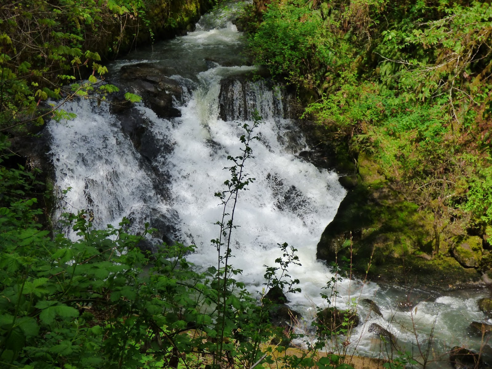
 On March 31, 2016, we hiked down to the roaring Bible Creek Falls. The sound is the only way to find it as it is many feet below the road and completely out of sight. We had spotted the area on a previous evening when mist from the falls drifted up into sight. We had clocked the spot at 1.2 miles from the junction of Nestucca River Road and Bible Creek Rd. Just past an old red 4 on a mile marker is a bend in the road and then a sort of grassy pull off where we parked. We hiked straight down from that pull off and arrived at the top of the falls. We could not see if there was more to the falls than this initial drop of maybe 20 feet. It then flattened out for another maybe 20 feet and disappeared.


  So we hiked downstream to where we could see the second drop, which is mostly occluded by logs. The creek is forced to go on either side of a massive log jam and also under it, surging out in froth below one vertical log. I hiked down to where I could see the entire falls, or as much as can be seen from any one spot. The upper falls is above the log jam in the photo below, the flat spot invisible behind the log jam, the water going around the log jam on both sides is barely visible, and then the lower drop with its log in the middle of itself.


Johnny stayed where he could see the top of the falls... and me as I made my way along the cliff.


I had a little more view of the flat below the top falls from a position higher on the steep (nearly vertical) cliff.


 On my hike back out of the gorge, I came to a spot where I could see the falls between trees.


Without having seen the mist rising from the falls that one evening, it would have been a challenge to find this falls. It is louder above but since you cannot see the falls until you are almost to it, it takes an act of faith to head down that steep, wooded and brushy cliff. We were not able to measure it, but the 56 feet on the Northwest Waterfall Survey page seemed about right, counting all three drops.